
In modern development, accurate spatial data forms the foundation of informed planning and safe construction. From land development to coastal engineering, specifically supporting marine infrastructure through hydrographic surveying allows decision-makers to design with absolute confidence. At the forefront of delivering this critical data is Datum One Surveys, Ltd. Co., a professional firm committed to precision, innovation, and dependable results.
Furthermore, Datum One Surveys provides a wide range of surveying services that support infrastructure, engineering, and environmental projects across the Philippines. With expertise in terrestrial, marine, and aerial environments, the company delivers accurate spatial information. Consequently, this enables projects to move forward both efficiently and safely.
Comprehensive Surveying Services
Surveying today goes far beyond traditional land measurements because modern projects require integrated datasets. Therefore, Datum One Surveys offers a full suite of services designed to meet these complex needs.
These services include:
- Topographic Surveys
- Parcellary and Property Surveys
- Construction and Engineering Surveys
- Aerial LiDAR and Drone Mapping
- Hydrographic Surveys
- Control Surveys and Geodetic Network Establishment
Through the use of advanced GNSS technologies and specialized processing software, the firm produces datasets that meet national geodetic standards.
Among these services, hydrographic surveying represents one of the company’s most specialized capabilities.
Hydrographic Surveying: Mapping the Hidden Terrain
While land surveys primarily map the Earth’s surface, hydrographic surveys, in contrast, reveal the landscape beneath the water. Moreover, these surveys measure the depth and shape of underwater terrain, which is commonly referred to as bathymetry.
Hydrographic surveys are essential for port and harbor development, dredging projects, coastal engineering, marine infrastructure planning, navigation safety, and environmental and geotechnical studies.
While only a limited number of firms provide hydrographic services due to their technical demands, Datum One Surveys, however, effectively bridges this gap by integrating advanced technologies such as single beam echosounders along with GNSS RTK positioning.
Featured Project: Bathymetric Survey for the Proposed Batangas City Port
One of the most significant hydrographic projects handled by Datum One Surveys is the Bathymetric Survey of the Proposed Port Site at Barangay Cuta, Batangas City. This project represents a major milestone for the company and demonstrates its capability to undertake large scale marine surveys.
The survey supports the feasibility and preliminary engineering design for a planned port development southeast of the existing Batangas City Port. The project covered approximately 300 hectares of coastal and nearshore waters, making it one of the most extensive hydrographic surveys undertaken by the firm.
The objective of the survey was to obtain detailed seabed elevation data that would help engineers assess the suitability of the site, estimate dredging requirements, and identify optimal locations for berthing areas and navigation channels.
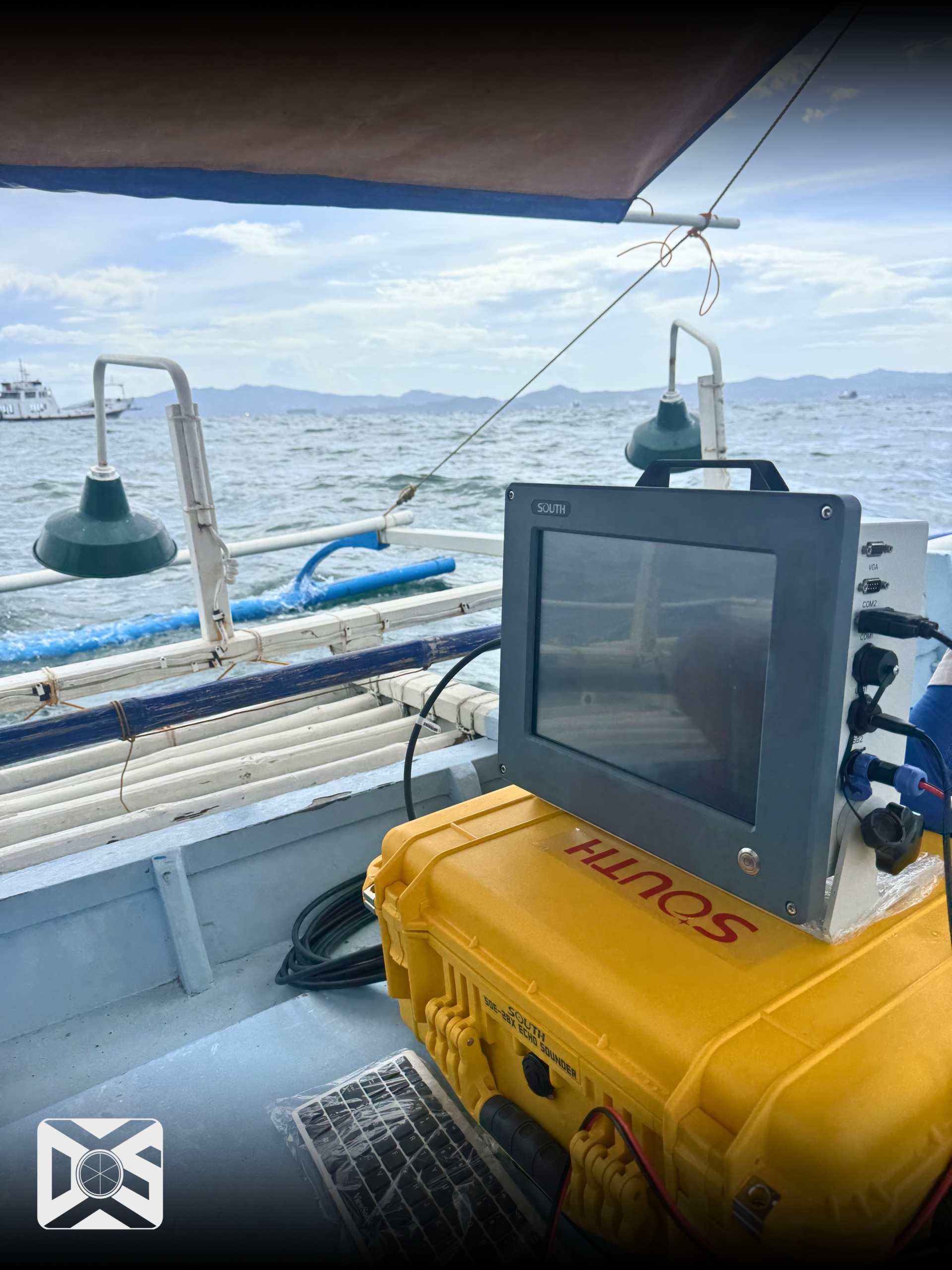
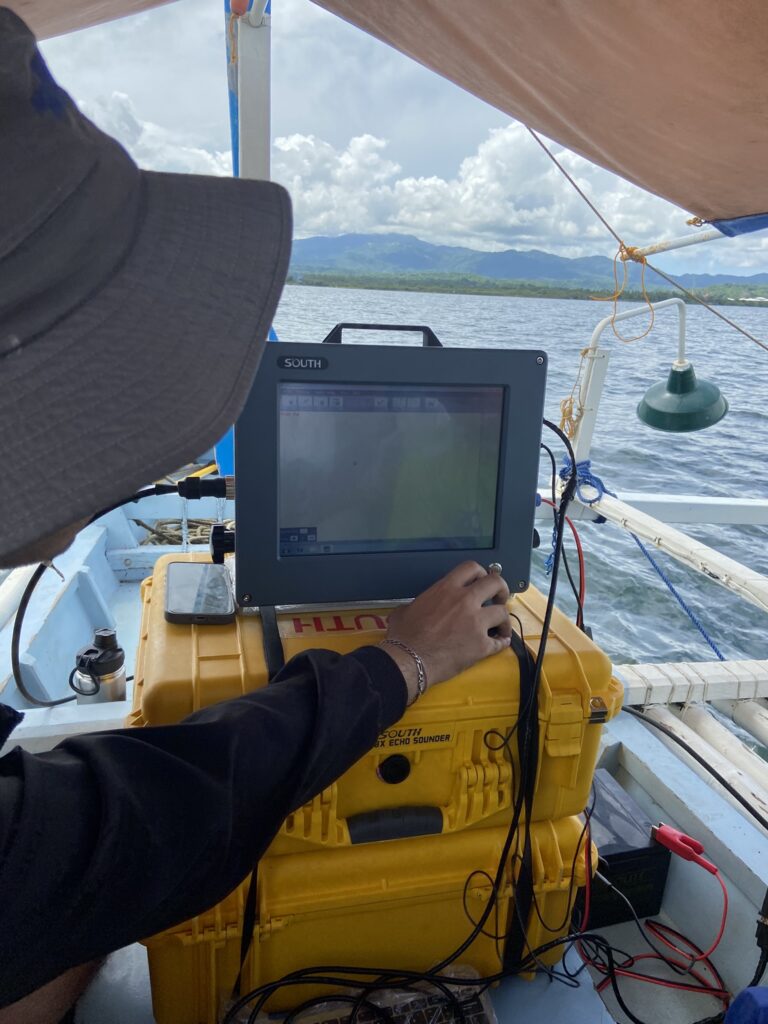
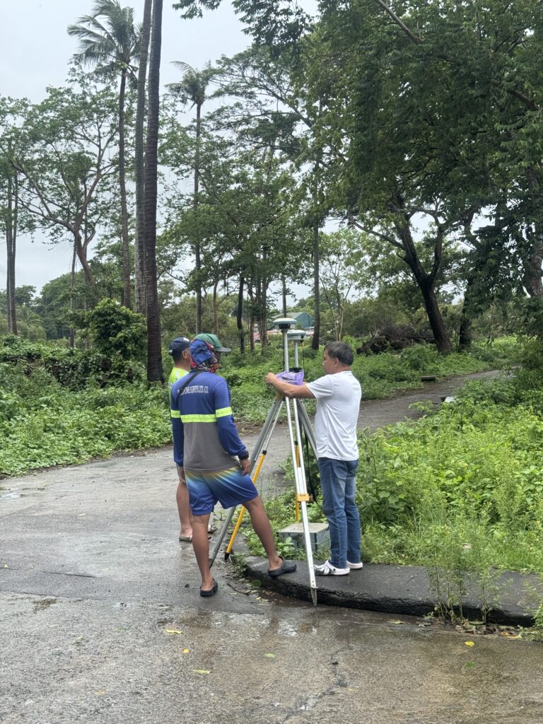
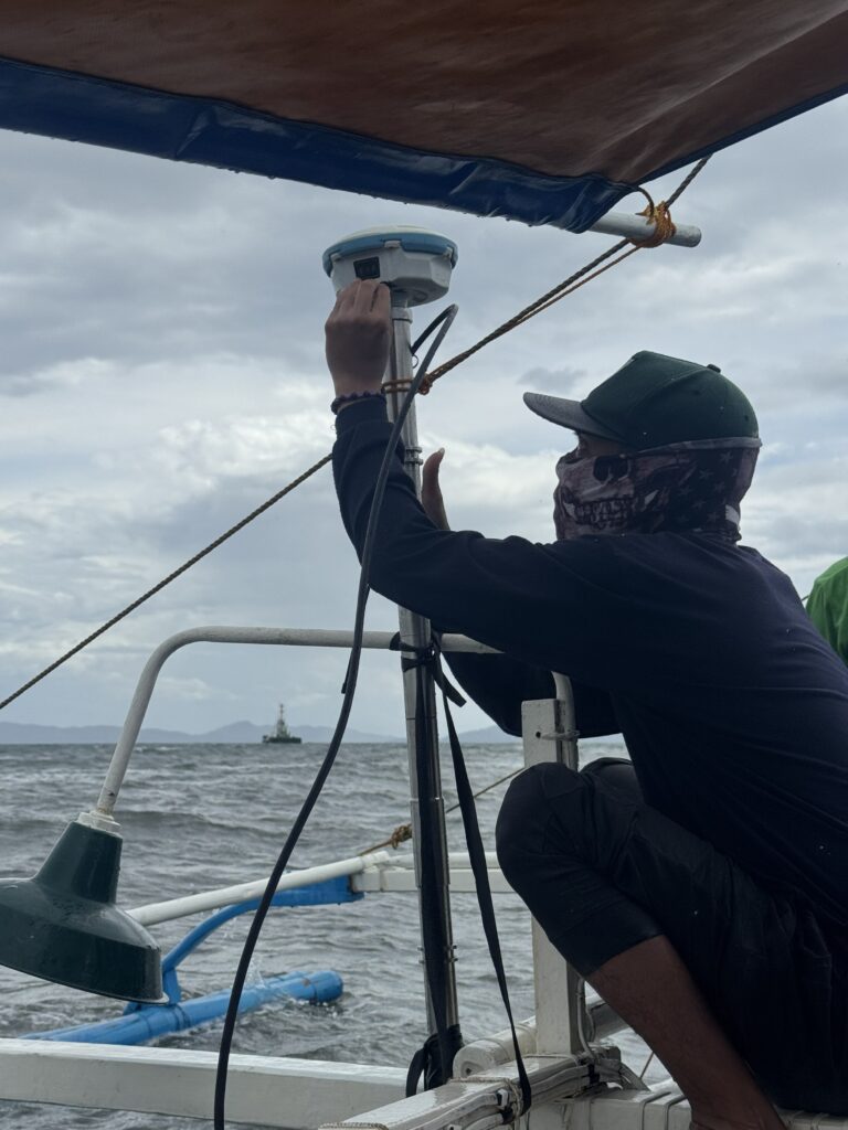
To accomplish this, Datum One Surveys deployed a single beam echosounder integrated with GNSS RTK positioning mounted on a survey vessel (see Figure 1.a & 1.b). This system allowed for precise depth collection; furthermore, it ensured that accurate geographic coordinates were concurrently recorded in real time.

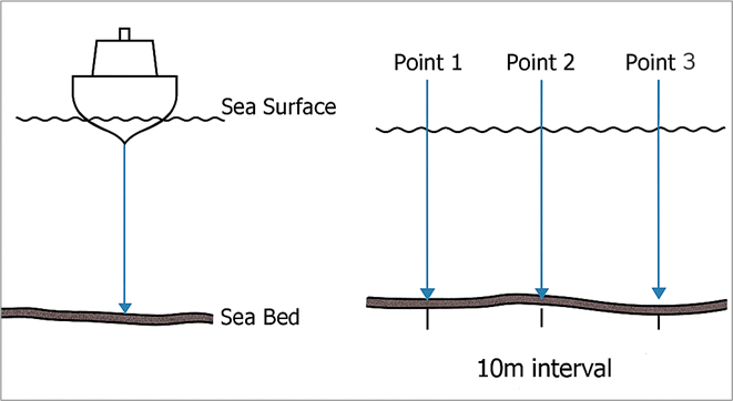
The team systematically mapped the site using parallel lines every 25 meters to ensure complete coverage. Depth soundings were recorded at regular intervals along each line to produce a detailed representation of the underwater terrain.
In addition to hydrographic measurements, Datum One Surveys established ground control points referenced to the Philippine Reference System 1992 (PRS92) and the Mean Lower Low Water (MLLW) tidal datum.
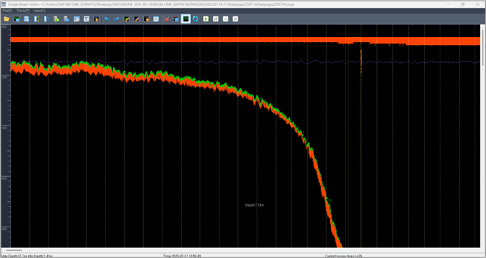
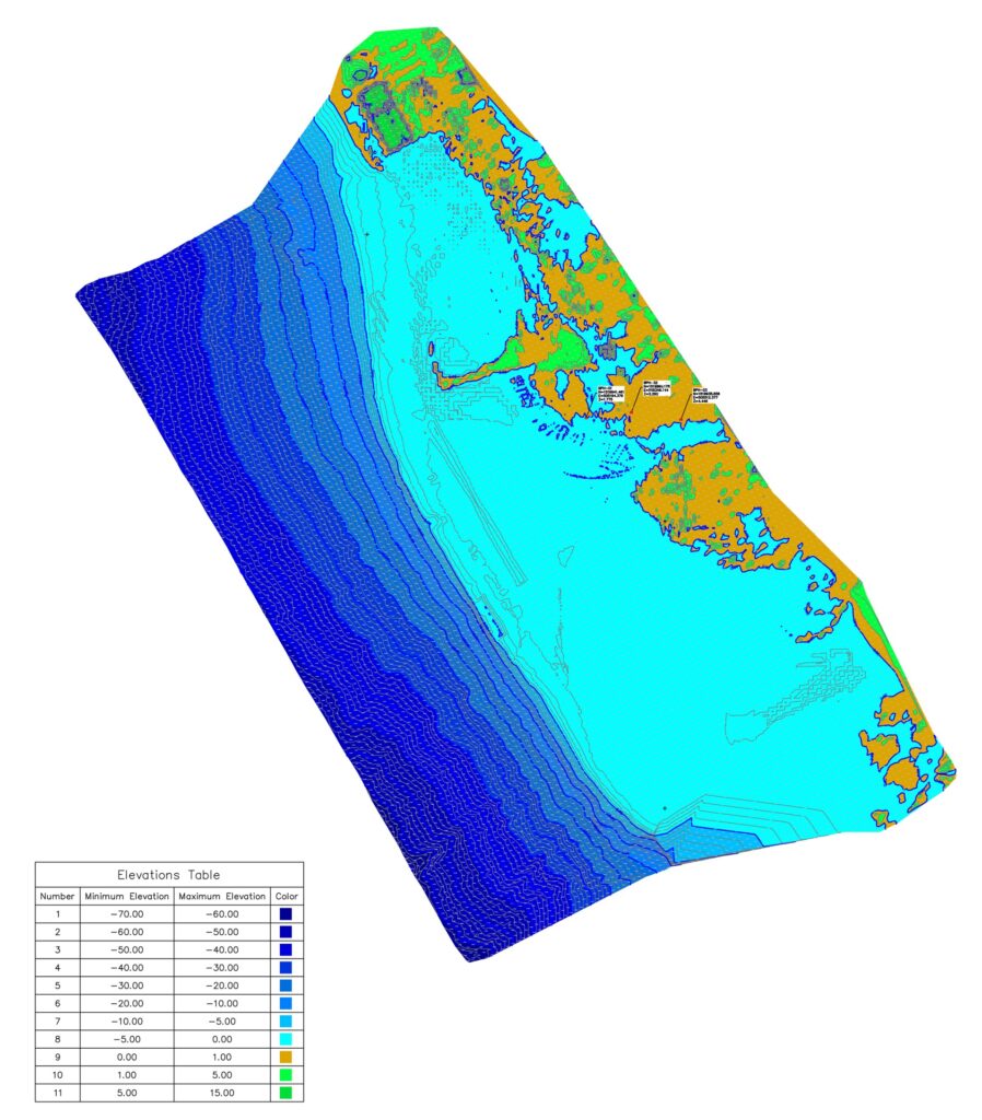
Integrating the processed bathymetric data with topographic and aerial LiDAR data created a continuous surface model of the project area. Using this dataset, the team generated Bathymetric maps (see Figure 2) representing seabed elevations and key underwater terrain features.
Commitment to Accuracy and Innovation
At Datum One Surveys, every project is guided by a commitment to technical excellence, reliability, and professional standards. By combining advanced technology with rigorous workflows, we provide clients with dependable and trustworthy spatial data.
From land to hydrographic surveys, Datum One continues expanding to provide high-quality geospatial data throughout the Philippines.