
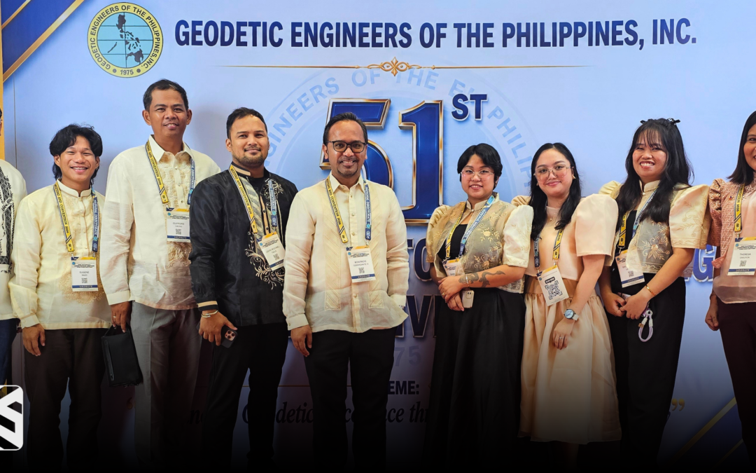
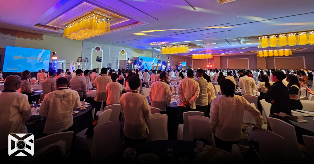
Datum One Surveys (DOS) engineers took an active role in advancing geodetic excellence by participating in the 51st National Directorate Meeting and Convention of the Geodetic Engineers of the Philippines, Inc. (GEP). Held on June 12–13, 2026, at the Royce Hotel, Clark Freeport Zone, Mabalacat, Pampanga, the two-day convention was anchored on the theme, “Advancing Geodetic Excellence through Innovation and Integrity.”
The event gathered geodetic professionals, government agencies, regulatory bodies, academic institutions, international organizations, industry partners, and private practitioners to exchange knowledge and discuss the future direction of the profession.

Coinciding with the 128th Philippine Independence Day, attendees wore traditional attire, honoring the profession’s contribution to nation-building.
Continuous Professional Development and Lifelong Learning
Supporting CPD activities ensures DOS engineers remain responsive to emerging technologies, updated regulations, and evolving industry demands. Discussions on PRC guidelines highlighted new CPD credits for self-directed and informal learning, promoting lifelong learning.
The academe also played a vital role in advancing the convention’s vision of innovation through research and scientific development. UP Diliman Department of Geodetic Engineering researchers shared emerging studies on geospatial science’s role in addressing contemporary challenges.
Dr. Rosalie B. Reyes presented on Philippine GNSS-IR implementation, highlighting innovative methodologies for environmental monitoring. Complementing this perspective, Prof. Czak Sarmiento emphasized the broader significance of geodetic and geomatics engineering in understanding our world. This discipline determines where events occur, measures and explains changes over time, and identifies what we must protect.
These academic discussions reinforced that advanced instruments, Artificial Intelligence, and digital technologies do not drive innovation in geodetic engineering alone. Continuous research, scientific inquiry, and new knowledge push the field forward. Combined with integrity, these advancements ensure accurate geospatial information that supports society and sustainable development.
Innovation Through Technology, Guided by Professional Integrity
A central message throughout the convention was that innovation and integrity must advance together. Court of Appeals Associate Justice Lauigan emphasized that despite technological evolution, geodetic engineering must prioritize accuracy and societal service.
Advanced instruments, GNSS, LiDAR, automation, and AI continue to transform modern geodetic practice into smaller, more powerful solutions. These innovations allow geodetic engineers to acquire more accurate data, enhance productivity, and complete complex tasks faster.
Justice Lauigan highlighted that every major infrastructure project begins with the accurate geospatial data geodetic engineers provide. He added that precise surveys protect property rights and serve as essential evidence for resolving legal disputes.
While technology transforms professional tools, integrity remains the foundation of trustworthy geospatial data. Geodetic excellence requires adopting innovative technologies while ensuring they are applied with ethical responsibility and professional judgment.
Strengthening the Profession Through Law, Standards, and Public Trust
Technical sessions led by Atty. Paolo M. Segubre, Past Regional President of GEP Region VI, examined actual land disputes and court decisions where geodetic expertise proved critical in resolving conflicts. Through practical legal cases, participants saw how accurate surveys serve as vital evidence in judicial proceedings. Consequently, while innovation continuously transforms surveying methodologies, professional integrity remains indispensable for ensuring fair justice and maintaining public trust.
Ultimately, geodetic engineering is a critical profession supporting infrastructure, environmental management, and justice. As tools advance, this innovation must be supported by responsive professional standards and governance frameworks.
Modernizing Technical Standards for Land Governance
In her presentation on inclusive land governance, Atty. Emelyne V. Talabis, Director of the Land Management Bureau (LMB), highlighted the continuing role of the Bureau in promoting efficient land administration and responsive land management systems. In response to the rapid advancement of geospatial technologies, discussions emphasized the need to continuously review and update existing technical standards, including the Revised Manual for Land Surveying Regulations (DAO Manual of Surveying), which governs public and private land surveys and establishes standards for cadastral, isolated, and geodetic surveys. With advancements in GNSS, digital mapping, automation, and Artificial Intelligence, participants recognized the importance of ensuring that technical guidelines remain relevant to modern surveying practices.
Complementing these discussions, Prof. Epifanio D. Lopez, Chairman of the Professional Regulatory Board of Geodetic Engineering, presented insights on Republic Act No. 8560 or the Philippine Geodetic Engineering Act of 1998, including its
continuing relevance and limitations in addressing emerging technologies and contemporary professional practice. His presentation underscored the importance of periodically reviewing the regulatory framework governing the profession to ensure that it remains responsive to innovation while upholding competence, accountability, and ethical standards.
The discussions also highlighted the important role of the Geodetic Engineers of the Philippines (GEP) in working alongside government agencies, regulators, academe, and industry stakeholders in advancing policies, standards, and technical guidelines that support innovation while safeguarding public trust. Together, these efforts ensure that technological progress is matched by sound professional governance, reinforcing the convention’s theme that geodetic excellence is achieved through both innovation and integrity.
Industry Collaboration and Emerging Geospatial Solutions
Industry partners introduced the latest surveying equipment and AI-assisted technologies that continue to reshape geospatial practice. These innovations steer the profession toward intelligent solutions while maintaining the engineer’s essential role in validation.
Engagements with Federation of Surveyors (FIG) and ASEAN Federation of Land Surveying and Geomatics (AFLAG) strengthened collaboration and aligned Philippine geodetic practices with global standards.
DOS Commitment to Advancing Geodetic Excellence
Through this convention, Datum One Surveys reaffirms its commitment to investing in engineer growth via CPD and emerging technologies. As the industry evolves, DOS embraces innovation while upholding the integrity, accuracy, and professionalism vital for national development.